Spatial query of coordinate reference systems and its integration with GRASS GIS
- Track: Geospatial devroom
- Room: D.geospatial
- Day: Sunday
- Start: 13:40
- End: 14:15
- Video with Q&A: D.geospatial
- Video only: D.geospatial
- Chat: Join the conversation!

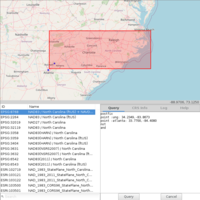
I introduce a new open-source geospatial project called ProjPicker (Projection Picker). ProjPicker is a Python module that allows the user to select all coordinate reference systems (CRSs) whose extent completely contains given points, polygons, and bounding boxes using set-theoretic logical operators in a postfix notation. The goal of this project is to make it easy and visual to select a desired projection by location. This project was motivated by a GRASS GIS feature request. A new GRASS GIS module g.projpicker that wraps around this project is already available. As part of its integration with GRASS GIS, this new feature will be added to the GRASS location wizard.
Speakers
| Huidae Cho |