100% open journey planning
Open source, open APIs, open data
- Track: Geospatial devroom
- Room: AW1.121
- Day: Sunday
- Start: 12:00
- End: 12:25
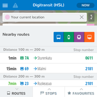
Take walking paths from OpenStreetMap, take public transport open data in GTFS format, deploy OpenTripPlanner, expose open APIs, customise any of the client applications. This is how next-generation journey planners are being built: open standards, open data, open APIs, open source code. Authorities in places such as Portland, New York State, Netherlands, Finland, Iceland and Oslo are already working this way in collaboration with citizens and businesses. Latest result of this model to replace proprietary solutions is Digitransit, a mobile-first HTML5 passenger information app by the main transport authorities in Finland (Helsinki Regional Transport Authority HSL and Finnish Transport Agency FTA).
This is an example how more civic tech should be built, which leads to more open source from the government. Transport has proven an easy and interesting field for citizen participation, as everyone has an itch to scratch, and it's visual with maps and realtime data. If the transport data is open in your city, you can set this up. If your city hasn't opened data yet, here's one reason why they should.
Speakers
| Tuukka Hastrup |